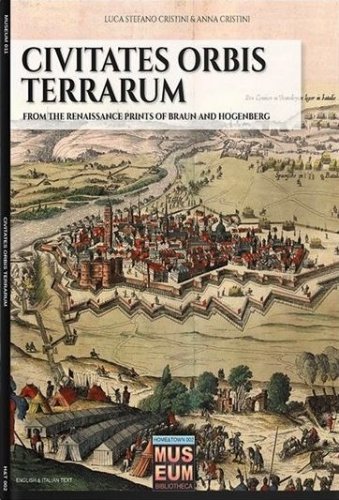
Civitates orbis terrarum
from the renaissance of Braun and Hogenberg
Civitates orbis terrarum
from the renaissance of Braun and Hogenberg
Cristini Luca Stefano, Cristini Anna
- Disponibile in 7 giorni
- Possibilità di reso entro 10 giorni lavorativi
- Transazione sicura con carta di credito, Paypal o bonifico bancario
- Spedizione tracciata con SDA
Uno dei primi atlanti della storia fu creato da Georg Braun nel 1572, grazie a miglioramenti tecnologici e nuove scoperte geografiche: la cartografia moderna stava crescendo. In questo primo volume sono riportate le 80 tavole che descrivono l'Italia, da nord a sud seguendo la navigazione attraverso le coste del Mar Mediterraneo. - One of the first atlases in history was created by Georg Braun in 1572, thanks to technological improvements and new geographical discoveries: modern cartography was rising at the same time with mankind during Renaissance. In this first volume dedicated to Civitates Orbis Terrarum are reported the 80 plates describing Italy, from north to south, and following the navigation through the Mediterranean Sea’s costs. We invite you to a trip where you can explore and recognize familiar cities and towns, but are you ready to discover their appearance five centuries ago?
Autore
Ean / Isbn
978889327473
Pagine
96
Data pubblicazione
14/06/2019

