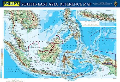
South-East Asia reference map
laminated scala 1:5.200.000 cm.107X77
South-East Asia reference map
laminated scala 1:5.200.000 cm.107X77
- Disponibile in 48 ore
- Possibilità di reso entro 10 giorni lavorativi
- Transazione sicura con carta di credito, Paypal o bonifico bancario
- Spedizione tracciata con SDA
A physically coloured map for the office or study, it features country boundaries, major cities, towns, roads, railways, airports, rivers and sea contours clearly shown for the whole South-east Asia region. It also includes a small-scale inset map showing the area in political colouration, identifying the countries making up the Association of South-east Asian Nations (ASEAN), together with their flags.


